de Wit, Frederick
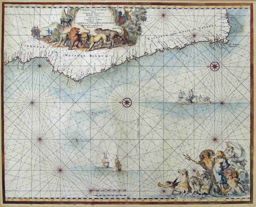
CIMBEBAS ET CAFFARIAE LITTORA A CATENBELA AND PROMONTORUM BONAE SPEI. Amsterdam, 1680 first edition
About this Item
de Wit, Frederick
CIMBEBAS ET CAFFARIAE LITTORA A CATENBELA AND PROMONTORUM BONAE SPEI. Amsterdam, 1680 first edition
The hand coloured Marine chart has a large title piece with lions, native tribesmen and European traders. Contains a cartouche of Neptune at the bottom. Depicting the coast from Luanda to the Cape of Good Hope to Fish Bay.
Guide to Maps of Africa, p. 124 and plate 95
44,5 by 55cm excluding frame; 70,5 by 80,5 by 2cm including frame
More from South African and International Fine and Decorative Art
Hanging Box
ZAR 4 000 - 6 000
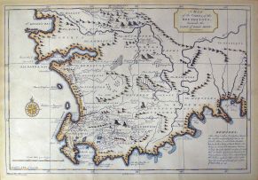
After Kolben, Peter
A MAP OF THE COUNTRY OF THE HOTTENTOTS, TOWARDS THE CAPE OF GOOD HOPE. Netherlands, circa 1750 first edition
ZAR 1 000 - 1 500
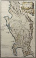
L S De La Rochette
THE DUTCH COLONY OF THE CAPE OF THE CAPE OF GOOD HOPE BY L.S. DE LA ROCHETTE MDCCXCV. London, 1795 first edition
ZAR 2 500 - 3 500
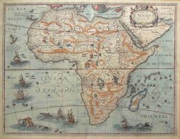
Bertius, P and Tavernier, M
CARTE DE L'AFRIQUE, CORRIGÉE ET AUGMENTÉE DESUS TOUTES LES AUTRES CY DEUANT FAICTES PAR P.BERTIUS. Paris, 1627 first edition
ZAR 3 500 - 5 000
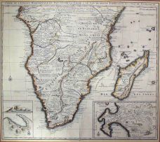
Nicolas Janz Visscher II
CARTE DE L'AFRIQUE MERIDIONALE. Amsterdam, 1730 first edition
ZAR 4 000 - 6 000
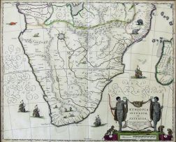
Blaeu, Joan
The hand coloured map bears a large title piece with a cartouche of native huntsmen, monkeys and tortoises. Depicts Southern Africa from the Cape of Good Hope to the Congo on the left and Mozambique on the right. Hand coloured. Sources: Grooten Atlas Volume 8, first edition and Norwich-Stone, Maps of Africa, pages 174/175, map No. 154
ZAR 2 500 - 3 500